

Transnavicom Electronic Maps are guide maps of cities and countries combining detailed electronic maps and comprehensive databases of companies. These programs, based on a unique raster-and-vector technology, offer unparalleled speed performance and accuracy of cartographic information.
Basic features of all the Electronic Maps:
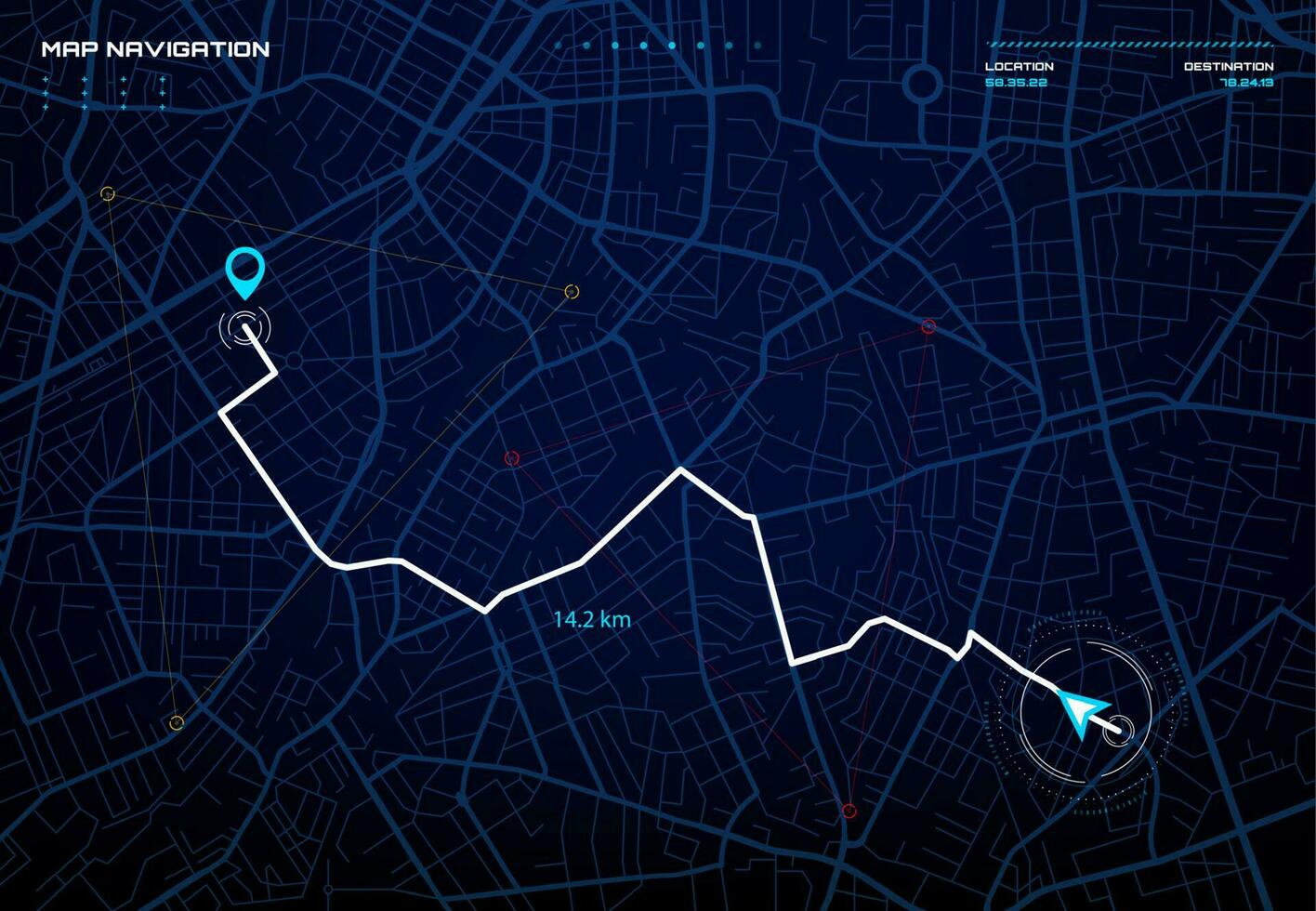
Transnavicom Navigation Maps — these programs are based on the Electronic Map and GPS technologies.
Having a GPS receiver, you will be able — without extra payment — to easily determine your location within a terrain, identify the shortest car route, and fully use the advantages of satellite navigation. Without a GPS receiver, the program is a powerful logistical tool.
Transnavicom Satellite Maps — these programs are based on ultra-precise satellite images produced by QuickBird satellite and the popular new generation Eletronic Map technology!
Using them, you can search for streets, houses, or districts. The satellite imagery allows seeing all houses, smallest turns of streets, cars of the roads, road markers, etc.
Features:
Transnavicom’s experts have developed a unique toolkit for integration of a digital map with your software.
In the many years of fruitful collaboration with companies operating in various fields, we analyzed multiple software products considering the nature of work and business problems of such enterprises. The result of this long and hard work is the versatile and easy to use Microsoft Windows dll TrueWay
You no longer need to purchase expensive GIS’s, retrain personnel, ponder over mismatch of the features of new software and peculiarities of operation of your company. Now you can simply add an electronic map to your regular and familiar software. But there is more!
Your software engineers will be able to implement the following features in a familiar development environment:Many companies dealing in freight forwarding or express delivery aim for saving transportation costs. This is where we can help, too! Special genetic algorithms provide for the revolutionary fast calculation of the optimal route for visiting all delivery destinations. Now you will save both time and money, and earn more by completing more orders.
Organizing route sheets using calculated routes, with street names and distances to go. You can combine the features any way you like, resolve any specialist problems, build any interfaces. All this can be done in your existing or newly created software. Technical support professionals and data updates will be a gainful addition to your new purchase.

Transnavicom Control Systemis a modern GPS/GSM system permitting control and tracking of any objects!
We are offering a guarantee of your safety and safety of your family and friends, of security of your property. Besides, you can improve efficiency of your business by tracking the movement of your employees and vehicles. No intermediaries, no user charges! / No tying to a specific mobile operator! / No Internet connection required!
You can control the objects you need using your office or home PC, or even your cell phone! All you need is to install a mobile terminal on the object, and a base terminal with a detailed map (where the objects will be shown as dots, and their tracks as lines) on the computer the information will be sent to. All the information will be safely stored in the archive for further analysis
Main functions of Transnavicom Control System:
“Business-Logistics” Software Suite is a toolkit for automation of operation of a haulage company dispatcher service. It is used for accounting of haulage orders and their assignment within the fleet of available vehicles in a way that improves the efficiency of work and cost reduction.
Includes:
Taxi Coordinator is a new generation software system for fast and convenient organization of taxi dispatcher services.