Orthodox Map

INTRODUCING THE NEW TRANSNAVICOM PROGRAM MILITARY TOPOGRAPHIC MAP OF UKRAINE For the first time, 286 military maps of the entire territory of Ukraine are published in electronic form and are available for civilian use. MILITARY TOPOGRAPHIC MAP OF UKRAINE has a scale of 1:100,000 (1 cm = 1 km). The map shows: the borders of regions and districts, populated areas, a detailed road network, rivers, streams, canals, elevation marks, forests, forest plantations, swamps, salt marshes andmuch more.

Orthodox Map

INTRODUCING A NEW VERSION OF THE TRANSNAVICOM PROGRAM: Kyiv NAVIGATION MAP + GPS For the first time, Vyshgorod, Bucha, Irpen, Brovary, Boryspil, Vyshneve, Sofievskaya and Petropavlovskaya Borshagovka have been added to the Kyiv map, with house-by-house detailing, a route calculation system and a GPS navigation function. When connecting a GPS receiver, the program allows you to instantly determine your current position on the map, calculate the shortest car routes and take full advantage of satellite navigation. Without a GPS receiver, the program allows you to solve various logistics problems. The "Route Planner" mode allows you to build complex routes: delete and add arbitrary route points, save calculated routes and print them.

Orthodox Map

Transnavicom Odessa Navigation Map + GPS (v7.0)

INTRODUCING A NEW VERSION OF THE TRANSNAVICOM PROGRAM NAVIGATION MAP OF ODESSA + GPS For the first time, a map of Ilyichevsk has been added to the detailed map of Odessa, with details down to houses and a GPS navigation function. The program has two operating modes: • Navigation system – for Netbook and Notebook, when connecting a GPS receiver • Electronic map with logistics functions – for desktop PCs
Orthodox Map

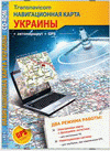
Transnavicom Navigation map of Ukraine (v1.4)

We present to your attention a new product from our company – Transnavicom Navigation Map of Ukraine! For the first time, a detailed map of Ukraine is available for solving logistics and personal navigation problems. The program works as an electronic map with logistics functions (for desktop PCs), as well as an autonomous navigation system (for laptops with connected GPS receivers).