
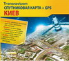
We present to your attention a new version of the Transnavicom program Satellite map of Kyiv. For the first time in this version of the product: all streets and houses are signed on the city map, the shortest car routes can be calculated, any fragment of the map can be printed, work on a local network, the GPS navigation function is available. Spatial resolution is 60 centimeters in one pixel, allows you to see all the houses, buildings, the smallest bends of the streets, and even crowds of people in the squares of the city of Kyiv. Coverage area is 1359 square kilometers, includes the entire administrative territory of Kyiv, as well as the nearest suburbs.
We present to your attention a new version of the Transnavicom program Satellite map of Kyiv. For the first time in this version of the product: all streets and houses are signed on the city map, the shortest car routes can be calculated, any fragment of the map can be printed, work on a local network, the GPS navigation function is available. Spatial resolution is 60 centimeters in one pixel, allows you to see all the houses, buildings, the smallest bends of the streets, and even crowds of people in the squares of the city of Kyiv. Coverage area is 1359 square kilometers, includes the entire administrative territory of Kyiv, as well as the nearest suburbs.
We present a new program created on the basis of ultra-precise satellite images of QuickBird and the popular technology "Transnavicom Electronic Map" of the new generation! Spatial resolution - 60 centimeters in one pixel, allows you to see all the houses, buildings, the smallest bends of the streets of Dnepropetrovsk. Coverage area - 532 square kilometers, includes the entire administrative territory of Dnepropetrovsk, as well as the nearest suburbs.

We present a new program created on the basis of ultra-precise satellite images of QuickBird and the popular technology "Transnavicom Electronic Map" of the new generation! Spatial resolution - 60 centimeters in one pixel, allows you to see all the houses, buildings, the smallest bends of the streets of Dnepropetrovsk. Coverage area - 532 square kilometers, includes the entire administrative territory of Dnepropetrovsk, as well as the nearest suburbs.